A rummage in Wycombe Reference Library turned up some interesting stuff.
An article in 'Architect's Journal' December 8th 1960, 'Central Redevelopment at High Wycombe'. Has various plans that show the Abbey Way Flyover and a pedestrian precinct that appears to have an open roof with the tower of the parish church looming above.
" The basis of the scheme is the complete separation of pedestrians from vehicles…The River Wye, which crosses the central area, has its banks lined and planted as a town centre amenity…The new scheme, properly designed and incorporating the river, can be brought into harmony with the character of the town."'Architect's Journal 20th October 1965, 'High Wycombe Central Redevelopment'. On the notion of the inner relief road:
"…such a solution as has been proposed, with an elevated motor road through the heart of the old town, makes me seriously ask to whom or what it is intended to bring 'relief': true the motorist may pass through more quickly, but for the citizens the cure seems worse than the disease." Goes on to suggest that a complete inner rind road is the obvious alternative and:
" A new scheme is clearly required , based on the Buchanan principles of placing environmental considerations before the convenience of through traffic."'Architect's Journal' 3rd November 1965 has a response form F.B. Pooley, chief architect for the scheme. The flyover is justified on the basis that:
"Not only will it solve the traffic problem but it will visually enhance the townscape…" The Council have recently announced plans to pull down the Abbey Way Flyover.
I discovered a stack of old maps and plans on top of the filing cabinets at the back of the room. One if which was 'The Wycombe By-Pass Special Roads Scheme 196_'. This covered West Wycombe to Bourne End. In appearance it seemed to be much older. Between Toweridge Common and Sands Wood it has a spot marked 'Druid's Hut'. This is on the 'Nodules of Energy' route. It also shows the old chalk pits in West Wycombe Park.
Stumbled upon Henry Kingston's 'History of Wycombe' from 1848. Has a description of the town by Will Camden written in the History and Antiquities of Britain, 1610:
"This towne for largenesse and faire building, is equal to the greatest townes in this shire..." Also gives a tour of the town and has a chapter entitles 'A Wycombe Perambulation' which was a title I was contemplating for something only the day before.
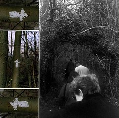
After this did a lap of the Rye with the Simply Walk group who meet every Wednesday. They found the notion of the algorithmic derive intriguing, although it wouldn’t work on the wide expanse of the Rye.
Finished the day with a bottle of Wychert Ale, bearing the Swan motif on its label, from the Bucks Vale Brewery.